
The app for crime and crash scene mapping
Never leave a scene unmapped! Add instant 3D scanning to your crime and crash scene documentation protocols with Dot3D. It’s never been easier (or more affordable) to equip entire teams of investigators, state troopers, police officers, and more. Your phone or tablet is now an instant 3D documentation tool that can be deployed in a matter of seconds and deliver accurate results in a matter of minutes.
Clear the scene in record time. Every time.
Trusted by leading organizations:


Featured Projects

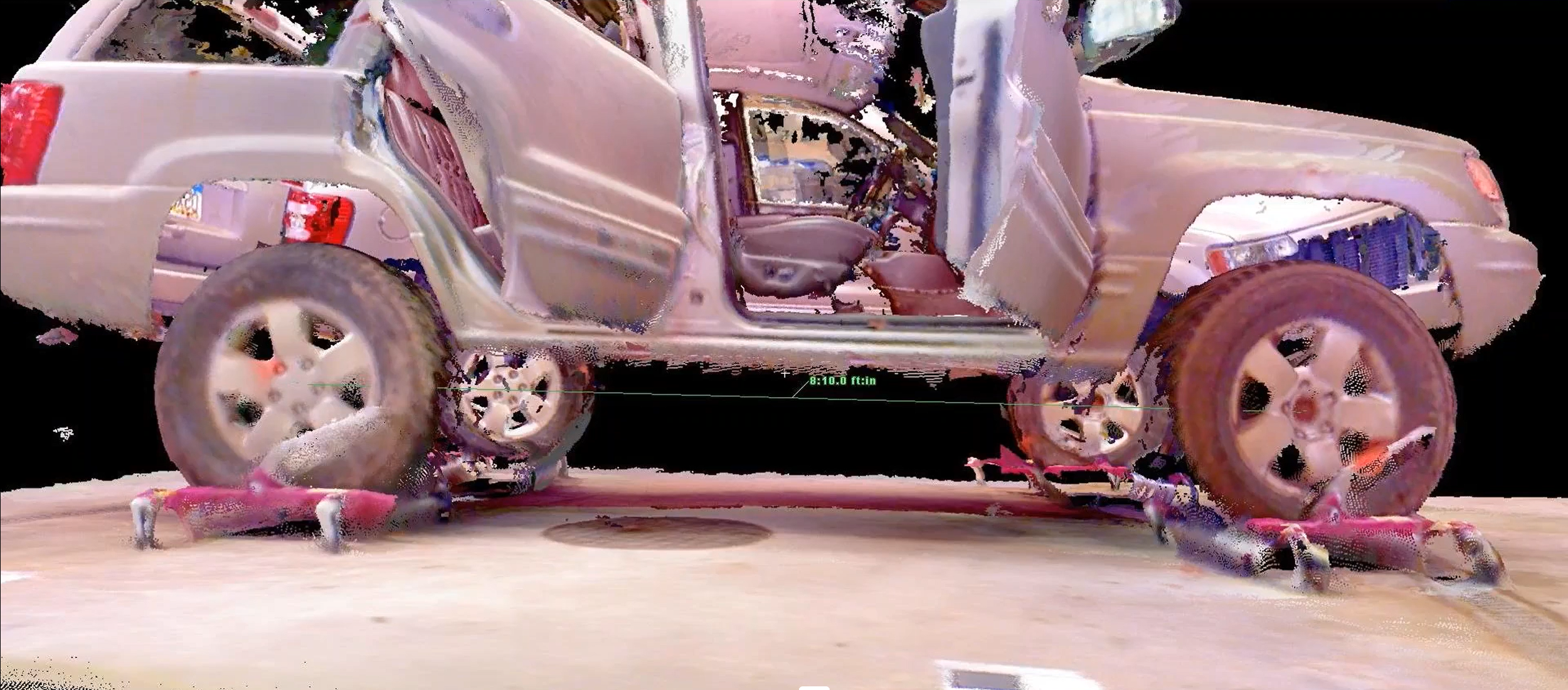
Handheld 3D Scanning Data Supports Conviction in Criminally Negligent Homicide Case
“At the trial, Bush used the Dot3D software to show the jury the force lines and vehicle crush navigating in real-time to multiple points of view, including perspectives from the front of the vehicle looking back, the side…”
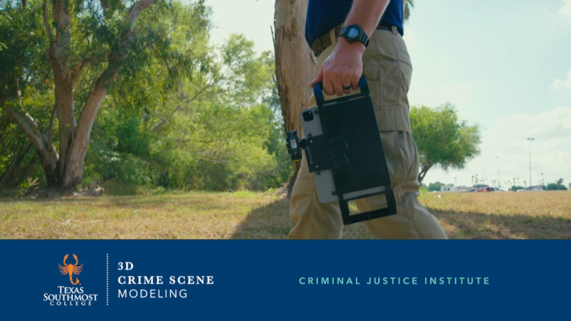
3D Crime Scene Modeling with Dot3D at Texas Southmost College
"The 3D Crime Scene Modeling class has been designed using innovative technology that rapidly records a crime scene, eliminating the need for cumbersome traditional procedures…”
Handheld Scanner Applications in the Omaha Police Department Forensic Investigations Section
“The scanner meets our expectations for precision and accuracy as it is pertains to measuring spatial relationships at crime scenes. Approval is recommended for the instrument…”
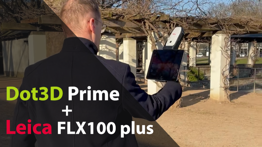
Learn how to automatically geo-reference your Dot3D scans with the Leica FLX100 plus
“So, not only are you gaining automatic global positioning of your scans to highly accurate GNSS/RTK coordinates, but you’re also improving the local accuracy of your Dot3D scans automatically…”

Preserving the Evidence and the Growing Role of 3D Laser Scanning
"Did you know? The 1st mission of the CSI at the scene of a crime is to freeze the scene. The traces and clues must be fixed with precision. Today, these observations are made in 3D!"
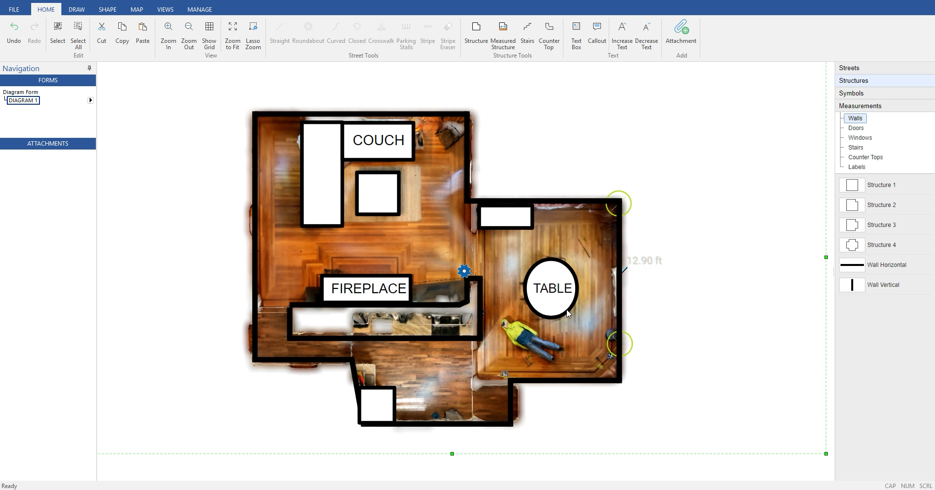
Dot3D scanning straight to 2D crime and crash scene diagramming with AutoScene Draw
“Users can now rapidly and accurately capture all the 3D/2D details needed for 2D diagramming, and then send a scaled image map straight to AutoScene Draw for convenient diagramming right over reality.”
A game-changer for crime and crash scene documentation
Accuracy you can count on
Control the results. Lock down the scene.
Automatic accuracy improvement via proprietary optimization
Extra reliable results via loop closure (with or without targets)
Reference measurement and control targeting workflows
Real-time GNSS integration for automatic geo-referencing
In the form factor you’ve been waiting for
Start scanning from just your phone or tablet.
Readily deployable, pocket-based, point-and-shoot technology
Now available for iOS, Windows, and Android mobile platforms
Use with embedded (LiDAR) or external (RealSense) 3D cameras
Compatible with rugged cases and supplemental lighting options
With the simplicity and security you need
Intuitive for all levels of law enforcement.
Truly instant data capture with real-time feedback and results
Rapid local processing with no cloud or internet requirements
Producing standardized color 3D point cloud deliverables
Easy diagramming via 2D drawing, screenshots, and partners
Uniquely affordable and deployable
Built to scale. And never go stale.
FREE trials available with unlimited capabilities for the first 7 days
Professional scanning plans starting at only $349.99 / year
Extensive compatibility with external hardware and software
Easily compatible with drones, tripods, total stations, and more
Ready? Let’s go.
Firsthand accounts from the field
-
![]()
"This application is the fastest and most adaptable mobile device scanning app we've seen."
- William Henningsen, Crime & Crash Scene Forensics, USA
-
![]()
“Today I had the chance to try out Dot3D and it was amazing. It's hard to understand the benefits of a tool like this until you actually try it out in the field."
-
![]()
“The more front line users that can preserve data in this detail, the easier my job will be a few years later when all the evidence is gone."
- Tom Morris, USA, Crash Scene Forensics
-
![]()
"Surveys can be completed in less time than with a terrestrial laser scanner. Also, the density of the points is high, making it easy to understand the location."
-
![imvisionlabs]()
“I’ve tried every LiDAR app and this one is hands-down the best. Made by professionals for professionals.”
- App Store Review, 2022, USA
-
![@O_Hitsuji_san]()
"What I like about Dot3D is that it has a fast processing time, yet still produces high enough accuracy that it's very useful."


-
Get started today with just an iPhone Pro (12 & up) or iPad Pro (2020 & up) with built-in LiDAR. If you prefer to start with a Windows or Android device, you’ll need an Intel RealSense or DPI external camera. The software trial is free on all platforms.
-
Pro is our most popular option for most iPhone/iPad users relying solely on their embedded LiDAR camera (iOS). Prime is a premium solution for leveraging external 3D cameras on Windows/Android or external GNSS receivers (i.e. Trimble DA2) on iOS.
-
YES! The use of coded targets (AprilTags) is one of the most important capabilities of Dot3D. Please click here to download Dot3D AprilTags for printing, and see here for several tutorials on their use. You also have the option to order a rugged set here.
-
Don’t worry! No automatic charges will occur. Once your trial ends, you’ll automatically revert back to FREE mode, still allowing scanning and testing, but with some limited functionality and NO EXPORTS. You may then upgrade to PRO or PRIME anytime.
-
YES! Your data is secure and 100% owned by you at all times. Cloud processing is never required and internet connectivity is only required once for initial license activation. All scans are saved locally and immediately backed up as soon as scanning is completed.
Ready to learn more?
Register below for instant access to our free guide to getting started with Dot3D for Public Safety: