
Dot3D Sample Data: By Use Case
NOTE: All samples shown on Sketchfab are HIGHLY DECIMATED (thinned out) for lightweight web viewing. To access the full density color point cloud data, please make sure to download the .DP data directly from each description on Sketchfab.
To open the full density DP scans on Windows (or Android/iOS), download Dot3D here and obtain a free trial license here.
From Dot3D, you may then export directly to E57, PTS, PTX, PLY, PTG, LAS, LAZ, RCS, and POD color point cloud formats.

Archaeology and Heritage
Sample Dot3D scans of archaeological and historical sites. Captured with various 3D cameras as indicated in each project title and description.
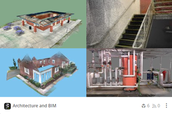
Architecture and BIM
Sample Dot3D scans of buildings and infrastructure. Captured with various 3D cameras as indicated in each project title and description.
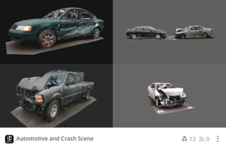
Automotive and Crash Scene
Sample Dot3D scans of vehicle and crash scenes. Captured with various 3D cameras as indicated in each project title and description.
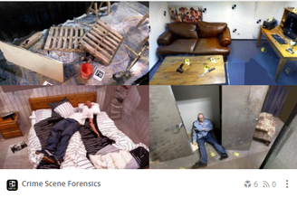
Crime Scene Forensics
Sample Dot3D scans of simulated crime scenes. Captured with various 3D cameras as indicated in each project title and description.

Industrial Applications
Sample Dot3D scans of various industrial spaces. Captured with various 3D cameras as indicated in each project title and description.

Kitchen & Bath
Sample Dot3D scans of kitchens and bathrooms. Captured with various 3D cameras as indicated in each project title and description.

Residential
Sample Dot3D scans of residentials apartments and homes. Captured with various 3D cameras as indicated in each project title and description.

Utilities & Infrastructure
Sample Dot3D scans of utilities and other infrastructure job sites. This includes several examples of different underground manhole scans.