
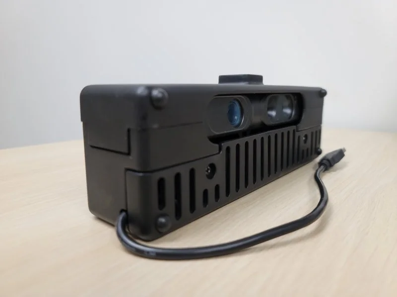
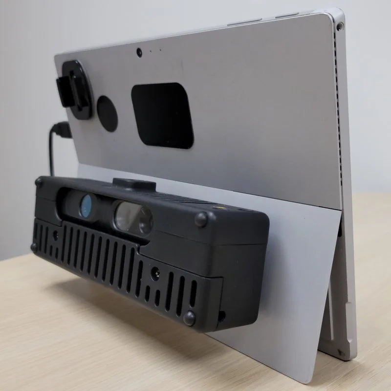
DPI-X Kit
The mountable DPI camera kit for attachment to a wide range of supported tablets and phone kits.
Trusted by leading organizations:


The smaller, mountable DPI option for convenient attachment to supported tablets and phones.
The DPI-X (2-12 ft range) includes the same calibrated 3D cameras (and associated specs) as the DPI-10 and DPI-10SR Kits. The difference lies in the form factor, compatibility, and cost. The DPI-X offers a wider range of compatibility and a lower price point, while the DPI-10/SR is superior in terms of overall ergonomics and ruggedness (including a rugged carrying case), but is only compatible with Microsoft Surface Go. For the most complete handheld 3D scanning solution, we still recommend the DPI-10/ DPI-10SR and a Surface Go 2 tablet.
Dot3D Prime license required for use (sold separately).


New with the DPI-X:
Secure mounting to any supported tablet/phone surface via Rokform mounting technology.
Compatible with Windows, Android, Surface Pro, Samsung Galaxy, rugged tablets, and more.
DPI scanning from your phone! Compatible with mounting to the iOgrapher Multi Case.
Smaller and lighter weight - Ideal for attaching to extension pole kits.
Proven, accurate, and versatile DPI 3D scanning at the lowest entry price to date.
-
Sensor Range: DPI-X: 0.6 m to 3.7 m (2 ft – 12 ft). DPI-XSR: 0.3 m to 2 m (1 ft - 6 ft).
Op. Temperature: 5 to 33 deg C (41-91 F).
Horizontal FOV: 57.5 deg.
Point Density: ≤ 1.7mm at 1m distance, ≤ 3.4mm at 2m distance.
Core Capabilities:
Instantly capture color 3D data with full freedom of motion.
Produce accurate and reliable results in complex environments.
Review and edit your point cloud data immediately on mobile device.
Export directly to industry standard color point cloud formats.
Compatible with Dot3D Prime perpetual or subscription license plans.
Professional features enable high accuracy scanning of larger areas.
Compatible with the DPI Light Kit, Pole Kit, and Accuscale-DP Kit.
Available Options:
Long Range (DPI-X): 2-12 ft range
Intel RealSense D455 for scanning in sunlight
DPI Light Kit for scanning in dark spaces
DPI Extension Kit for hard-to-reach areas


Featured Projects
iPhone 13 Pro LiDAR Mapping - Tokyo Digital Twin Award
“An amazing capture of a river park taken by iPhone 13 Pro. The attached video is a recording of the winning work of the “Tokyo Digital Twin Award". This was captured by one person using affordable hardware such as iPhone13 Pro, Drogger RWP (GNSS antenna), DJI OM 5 (gimbal), and applications such as Dot3D Pro for iOS (LiDAR capture) and ALES (RTK service).
This work is available to see on Tokyo Digital Twin platform. The “Tokyo Digital Twin Project 3D Archiving Event” was held from December 2022 to January 2023 by the Tokyo Metropolitan Government, as a part of the ”2nd Mincap Award”, a 3D city space capture event using LiDAR or photogrammetry sponsored by both public and private sectors. Tokyo seems to see this event as a test of extensive data collection by the private citizen using inexpensive equipment.
- Ryotaro Kato, GPR Survey Engineer on LinkedIn

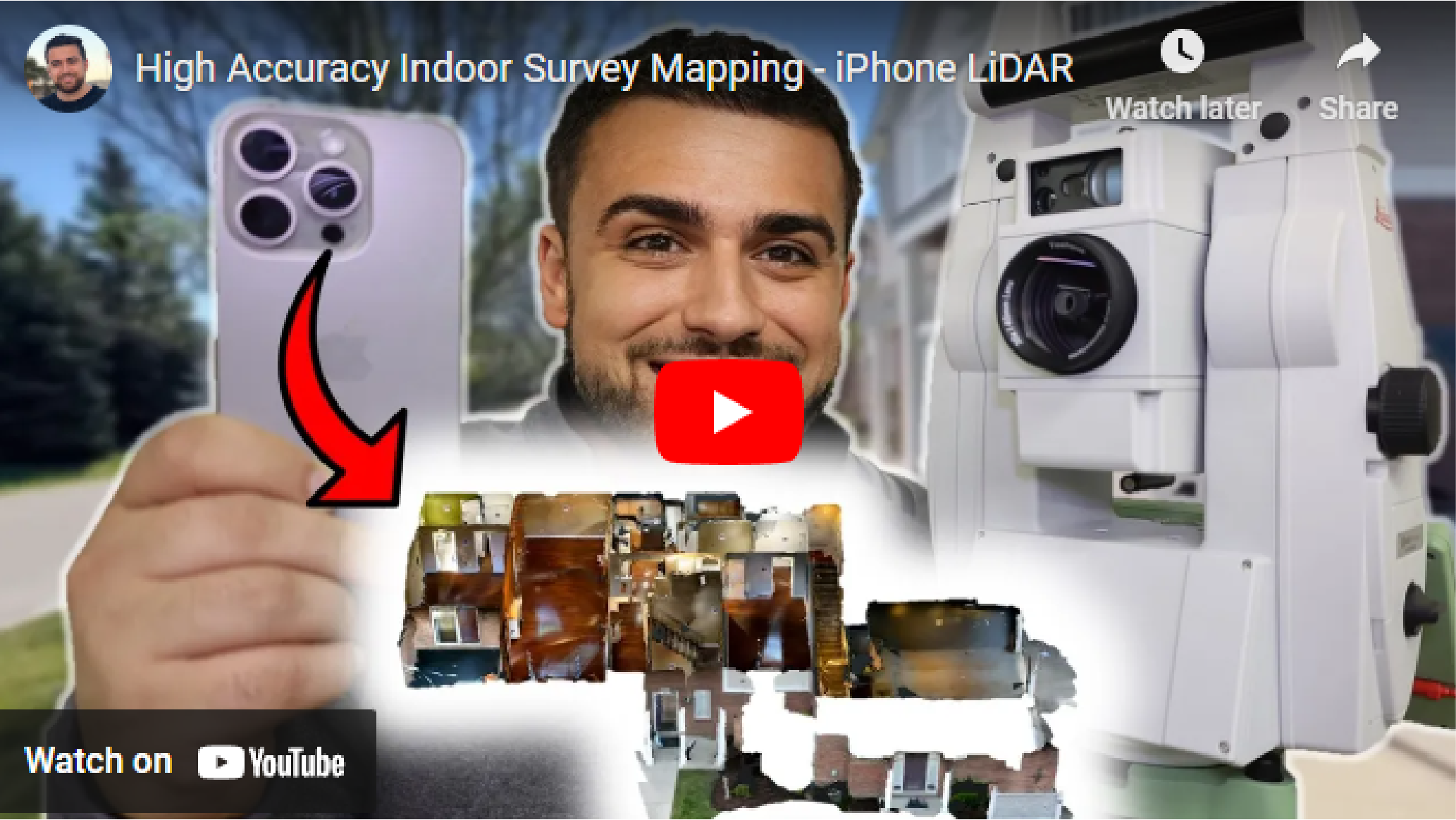
Indoor Survey Mapping with iPhone 15 Pro and Dot3D
“Today, we embarked on an exciting journey of indoor survey mapping using our iPhone 15 Pro.
Our mission? To map the inside of a condo with survey-grade accuracy, projecting everything into State Plane coordinates, and create a point cloud that we can integrate into other spatial data like a drone point cloud.
To ensure accuracy, we set up numerous April targets around the condo. Not only did these targets help us tie our scans together, but we also used a Total Station to survey all these targets, carrying our geodetic coordinates indoors.”
-Rami Tamimi, professional surveyor and geodetic engineer on YouTube
-
Get started today with just an iPhone Pro (12 & up) or iPad Pro (2020 & up) with built-in LiDAR. If you prefer to start with a Windows or Android device, you’ll need an Intel RealSense or DPI external camera. The software trial is free on all platforms.
-
Pro is our most popular option for most iPhone/iPad users relying solely on their embedded LiDAR camera (iOS). Prime is a premium solution for leveraging external 3D cameras on Windows/Android or external GNSS receivers (i.e. Trimble DA2) on iOS.
-
YES! The use of coded targets (AprilTags) is one of the most important capabilities of Dot3D. Please click here to download Dot3D AprilTags for printing, and see here for several tutorials on their use. You also have the option to order a rugged set here.
-
Don’t worry! No automatic charges will occur. Once your trial ends, you’ll automatically revert back to FREE mode, still allowing scanning and testing, but with some limited functionality and NO EXPORTS. You may then upgrade to PRO or PRIME anytime.
Let’s connect
Register below for instant access to our free guide to getting started with Dot3D: