
DPI-10 Kit
The new standard in handheld 3D scanning. Cross-platform and cross-sensor compatibility.
Trusted by leading organizations:


Firsthand accounts from the field
-
![]()
“Today I had the chance to try out Dot3D and it was amazing. It's hard to understand the benefits of a tool like this until you actually try it out in the field. What would have taken about a day and a half can now be completed in half a day...”
-
![@O_Hitsuji_san]()
"What I like about Dot3D is that it has a fast processing time, yet still produces high enough accuracy that it's very useful."
-
![]()
"Dot3D is very effective when surveying current conditions like this. Surveys can be completed in less time than with a terrestrial laser scanner. Also, the density of the points is high, making it easy to understand the location."
-
![imvisionlabs]()
"I used PotreeDesktop to visualize point cloud data acquired on an iPhone LiDAR. The colors look beautiful and the zoom in/out is very smooth and convenient! I used the iPhone LiDAR app Dot3D."
-
![]()
"Today we are inspecting a newly constructed building that stretches over 50m horizontally. We spent 10 minutes scattering 10 Apriltags while taking photos of the buildings, then 15 minutes observing the Apriltags with drogger RTK, and finally 10 minutes scanning with Dot3D. After returning to the office, it took about five minutes to import the CSV and optimize it. We were able to output point cloud data that allowed us to accurately measure the building's dimensions."
-
![]()
“Point clouds with high density and high contrast are easier to trace. The point cloud density of DOT3D is too high, so it can be used in practice even if it is thinned to about 10%.”
-
![]()
“The image shows a residential lot in Tokyo. Dot3D measurement range: 150 to 250 m2. When I converted it to LAS, the data size was about 250MB. If 2GB is possible, it seems like it would be possible to process almost an entire residential site in Tokyo. If we can classify them to this extent, it seems that the amount of work required for drawing in 3D → and 2D can be significantly reduced.”


The complete solution for instant, accurate, handheld 3D capture. Powered by Dot3D Prime.
Compatible with Microsoft Surface Go tablets (1, 2, 3, or 4). Also fully compatible with Intel® RealSense™ depth cameras for daylight scanning.
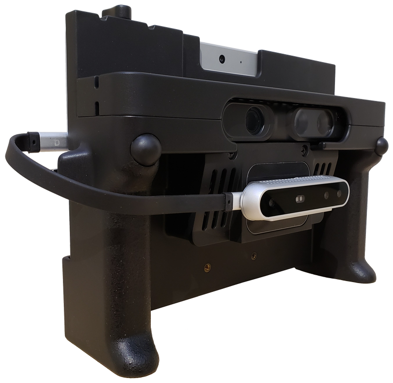


New with the DPI-10 and DPI-10SR (vs. the DPI-8):
Multi-sensor compatibility (PrimeSense, RealSense™, and more)
Daylight scanning capabilities (even in direct sunlight with Intel® RealSense™)
Windows OS support (via Microsoft Surface Go tablet)
Major increase in single scene capture sizes
Improved HD photo capture functionality


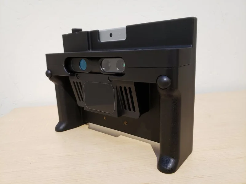
Core Capabilities:
Instantly capture color 3D data with full freedom of motion.
Produce accurate and reliable results in complex environments.
Review and edit your point cloud data immediately on the tablet.
Export directly to industry standard color point cloud formats.
Compatible with Dot3D Prime subscription or perpetual license plan.
Professional features enable high accuracy scanning of larger areas.
Compatible with the Light Kit, Pole Kit, and Accuscale-DP Kit
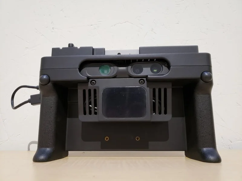
Available Options:
Long Range (2-12 ft range)
or Short Range (1-6 ft range)Android (Samsung Galaxy Tab S6)
or Windows (Microsoft Surface Go)Intel RealSense D455 for use in sunlight
DPI Light Kit for scanning in dark spaces
DPI Extension Kit for hard-to-reach areas
-
Screen Size: 10 inch.
Capacity: 64-256 GB (depending on tablet model). Tablet not included by default.
Export Formats: DP, PTS, PTX, PLY, PTG, LAS, LAZ, E57, POD (Windows only), RCS (Windows only)
Sensor Range: 60 cm to 4 m (2 to 12 ft.)
Op. Temperature: 5 to 33 deg C (41-91 F).
Horizontal FOV: 57.5 deg.
Point Density: ≤ 1.7mm at 1m distance, ≤ 3.4mm at 2m distance.
Power Supply: Using tablet battery.
Featured Projects
iPhone 13 Pro LiDAR Mapping - Tokyo Digital Twin Award
“An amazing capture of a river park taken by iPhone 13 Pro. The attached video is a recording of the winning work of the “Tokyo Digital Twin Award". This was captured by one person using affordable hardware such as iPhone13 Pro, Drogger RWP (GNSS antenna), DJI OM 5 (gimbal), and applications such as Dot3D Pro for iOS (LiDAR capture) and ALES (RTK service).
This work is available to see on Tokyo Digital Twin platform. The “Tokyo Digital Twin Project 3D Archiving Event” was held from December 2022 to January 2023 by the Tokyo Metropolitan Government, as a part of the ”2nd Mincap Award”, a 3D city space capture event using LiDAR or photogrammetry sponsored by both public and private sectors. Tokyo seems to see this event as a test of extensive data collection by the private citizen using inexpensive equipment.
- Ryotaro Kato, GPR Survey Engineer on LinkedIn

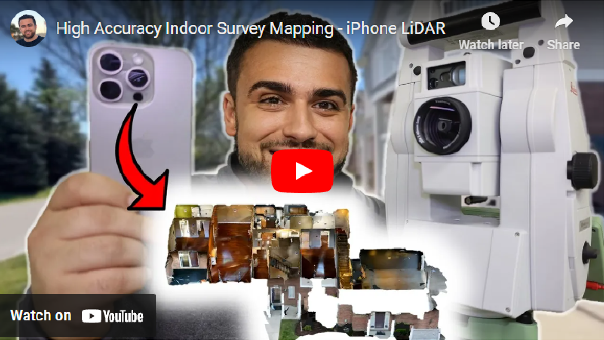
Indoor Survey Mapping with iPhone 15 Pro and Dot3D
“Today, we embarked on an exciting journey of indoor survey mapping using our iPhone 15 Pro.
Our mission? To map the inside of a condo with survey-grade accuracy, projecting everything into State Plane coordinates, and create a point cloud that we can integrate into other spatial data like a drone point cloud.
To ensure accuracy, we set up numerous April targets around the condo. Not only did these targets help us tie our scans together, but we also used a Total Station to survey all these targets, carrying our geodetic coordinates indoors.”
-Rami Tamimi, professional surveyor and geodetic engineer on YouTube
-
Get started today with just an iPhone Pro (12 & up) or iPad Pro (2020 & up) with built-in LiDAR. If you prefer to start with a Windows or Android device, you’ll need an Intel RealSense or DPI external camera. The software trial is free on all platforms.
-
Pro is our most popular option for most iPhone/iPad users relying solely on their embedded LiDAR camera (iOS). Prime is a premium solution for leveraging external 3D cameras on Windows/Android or external GNSS receivers (i.e. Trimble DA2) on iOS.
-
YES! The use of coded targets (AprilTags) is one of the most important capabilities of Dot3D. Please click here to download Dot3D AprilTags for printing, and see here for several tutorials on their use. You also have the option to order a rugged set here.
-
Don’t worry! No automatic charges will occur. Once your trial ends, you’ll automatically revert back to FREE mode, still allowing scanning and testing, but with some limited functionality and NO EXPORTS. You may then upgrade to PRO or PRIME anytime.
Let’s connect
Register below for instant access to our free guide to getting started with Dot3D: